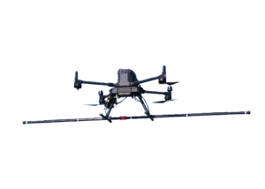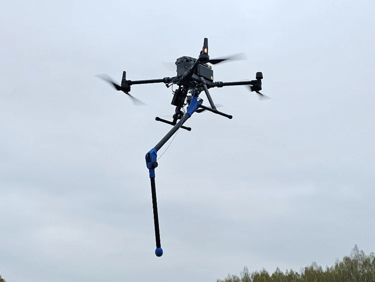
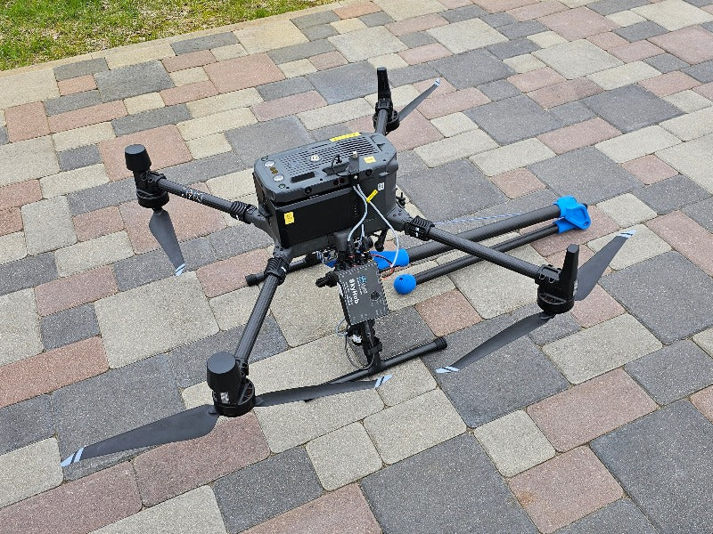
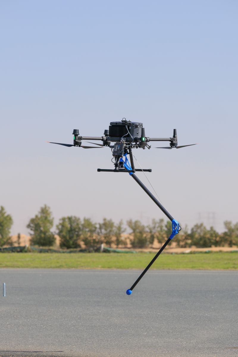
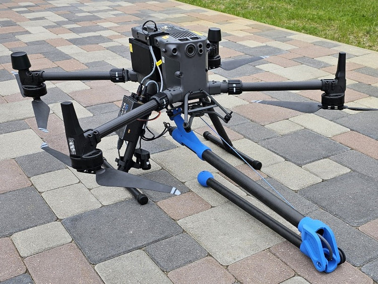
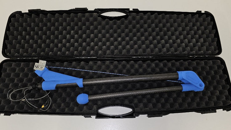
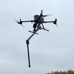
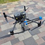
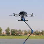
MagDrone R1
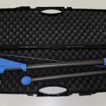
- Self-folding sensor arm
- Adjustable recording rate
Ready to start your project?
Contact us today for a free consultation and the best solution.
Description
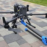
The MagDrone R1 is a drone-based airborne magnetometer solution designed for fast and efficient magnetic surveys of small to medium-sized areas. The system is used to map variations in the Earth's magnetic field with the goal of locating subsurface metallic objects (e.g., artifacts, pipes, metal contamination, or industrial magnetic anomalies) more effectively than traditional ground surveys.
The MagDrone R1 is suitable for use in geophysical surveys, archaeology, initial UXO clearance, and magnetic anomaly detection in infrastructure or construction areas.
SPECIFICATION
DOWNLOAD
Want to see more detailed specifications?
Download the full specifications PDF file via the link below.
General Questions
The MagDrone R1 is a drone-mounted magnetometer system for conducting aerial magnetic surveys to detect magnetic field anomalies and subsurface metallic objects.
MagDrone R1 umum digunakan untuk:
- Survei geofisika skala kecil–menengah
- Deteksi objek logam bawah tanah
- Arkeologi
- Investigasi awal UXO
- Identifikasi pipa atau struktur bawah permukaan
- Lebih cepat untuk area luas
- Aman untuk area berbahaya
- Tidak perlu berjalan kaki di seluruh area
- Efisien dalam waktu dan tenaga kerja
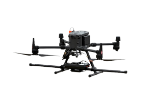
No. Must use a drone with:
- Payload minimal ±1–2 kg
- High stability
- Generally compatible with enterprise drones such as:
- DJI Matrice 300 RTK
- DJI Matrice 350 RTK
- DJI Matrice 400 RTK
Still unsure about choosing the right product?
Contact us today for a free consultation and the best solution.
Free Consultation