More Than Just
Tool Provider
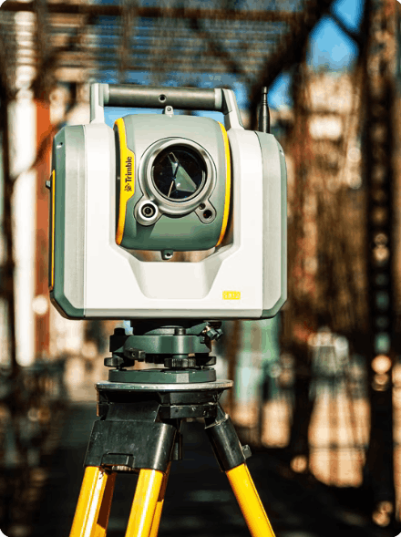
We don't just sell tools or provide services, but rather provide comprehensive solutions for your surveying and mapping needs. Our approach is focused on results, efficiency, and data reliability to support informed decision-making.
We offer integrated, accurate surveying and mapping solutions, supported by modern technology and an experienced team, to ensure projects are more effective and on target. With integrated services ranging from consultation and discussion, sales, service, training, to maintenance and calibration, we help clients achieve the best solutions, delivering reliable, efficient, and standardized measurement results.

20+ YEARS
For more than 20 years, PT GPS Lands Indosolutions has been a reliable partner in the fields of Geospatial, Drones, and Monitoring.

5000+ Clients
We have more than 5000 satisfied clients of our solutions throughout Indonesia

TRUSTED PARTNER
We have been partners in various companies from the Survey & Mapping, Agriculture, Mining, Oil & Gas, Construction, Government Agencies and other industries.