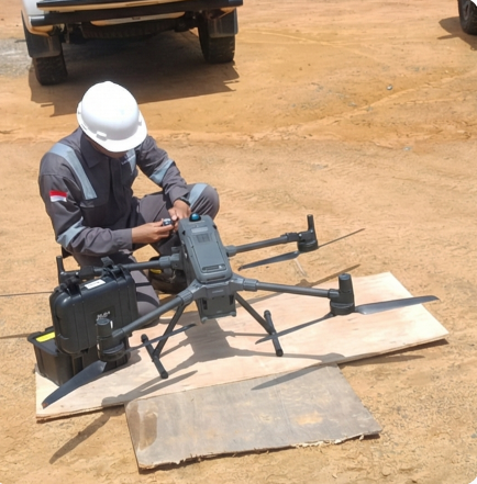
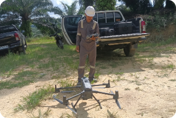
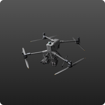
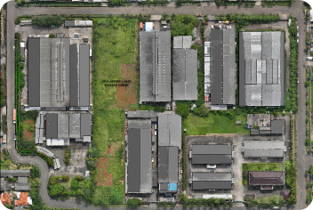
LiDAR Survey
Our Drone LiDAR technology utilizes active laser sensors capable of penetrating dense vegetation to generate high-precision 3D topographic models, offering a much more efficient and accurate mapping solution. The results can include 3D point clouds, contours, DTMs, orthophotos, situation maps, and 3D situation models.
Project
- Mining Site Road
- Plantation
- Construction
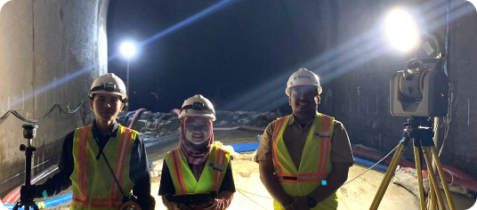
- Monitoring Tunnel
- Gas and Oil Pipelines
- Wellsite Area
Clients & Documentation

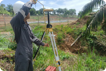
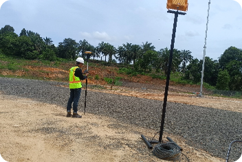
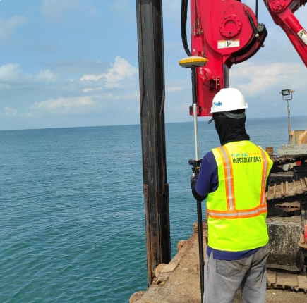
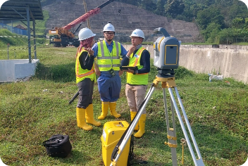
Topographic Survey
Topographic surveying is a technical mapping process that records three-dimensional land contours and features as the foundation for accurate project planning. We utilize GNSS geodetic technology, total stations, robotic total stations, and waterpasses.
Project
- Wellhead point determination
- Monitoring Tunnel
- Construction of BM Construction Point
- Determination of offshore drilling points
Clients & Documentation


Fotogrametri
Photogrammetry is a mapping technique that converts high-resolution aerial photographs into precisely measured 2D spatial data and 3D models. We utilize drone photography technology to acquire imagery over large areas quickly, efficiently, and with sharp visual detail. The results can be orthophotos and photo maps of the situation.
Project
- Land boundary measurement
- Situation Map Measurement
- Scouting wellsite work
Clients & Documentation
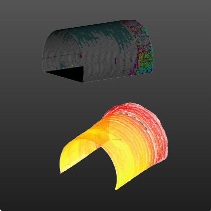
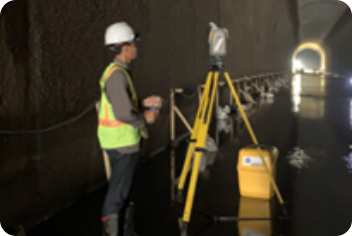
Building Deformation Monitoring
Our Building Deformation Monitoring detects structural shifts to ensure the safety of building assets. We combine the accuracy of a Total Station and a Terrestrial Laser Scanner to capture comprehensive spatial data. The acquired data is processed into a precise 3D model to visualize any geometric deviations in real time. This method produces a comprehensive stability analysis that provides the basis for accurate maintenance decisions.
Project
- Tunnel deformation
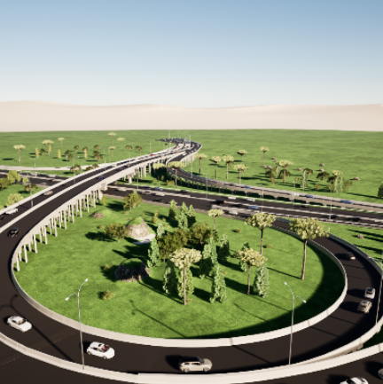
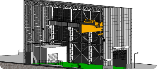
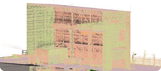
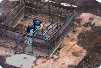
Scan to BIM 3D Laser Scanning
Scan to BIM offers a high-precision digital solution for transforming existing buildings and infrastructure into accurate and integrated BIM models. Using laser scanning and photogrammetry technology, every physical detail is comprehensively recorded in the form of a point cloud, then processed into a Building Information Modeling (BIM) model that realistically and reliably represents the as-built condition.
Project
- 3D Modeling of the Semarang-Demak Toll Road
- Wellhead Modeling
- Hydroelectric Power Plant Situation Modeling
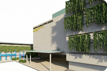
- Government Green Building Modeling
- Geological Data Modeling
- Sand Dune Tourism Area Modeling
Clients & Documentation
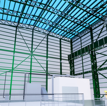
Digital Twin
A Digital Twin creates a comprehensive virtual representation of a factory's physical assets as a basis for accurate condition monitoring. We integrate BIM models with asset management systems to support data-driven maintenance planning. Applications: managing machinery, utilities, and production equipment to improve efficiency and asset lifespan. This solution facilitates more scalable and effective factory modernization and expansion strategies.
Project
- Steel Structure Modeling
Clients & Documentation