Land Survey
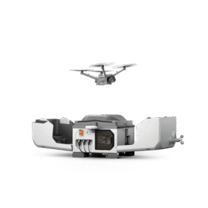
DJI Dock 3 (Drone In the Box)
Equipped with a high-performance Matrice 4D or Matrice 4TD drone, DJI Dock 3 enables 24/7 remote operation and, for the first time, supports vehicle-mounted mobile deployment, adapting easily to a variety of environments...
More
Terrasolid – Post Processing Software
Terrasolid is a professional software for large-scale LiDAR data processing and analysis, widely used in topographic mapping, corridor mapping, forestry, electricity, mining, and infrastructure projects...
MorePIX4D Post Processing Software
Pix4Dmapper (PIX4D) is a professional photogrammetry software used to process aerial and terrestrial photos into 2D maps, 3D models, point clouds, DSMs, and DTMs with high accuracy...
MoreAgisoft Metashape – Post Processing Software
Agisoft Metashape is a professional photogrammetry software used to convert photos (aerial and terrestrial) into 3D models, orthomosaics, point clouds, DSMs, and DTMs with high accuracy...
More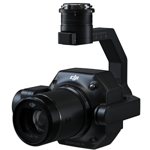
DJI Zenmuse P1
The DJI Zenmuse P1 is a full-frame photogrammetry camera payload designed for high-precision aerial mapping needs...
More
DJI Terra Post Processing Software
DJI Terra is a drone data processing software (photogrammetry & LiDAR) developed by DJI to convert aerial data into 2D maps, 3D models, and geospatial analysis quickly and accurately...
More