Mining
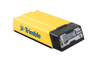
Trimble R750
Trimble R750 adalah receiver GNSS modular yang dirancang untuk kebutuhan survei, pemetaan, monitoring, dan aplikasi presisi tinggi lainnya...
More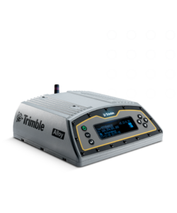
Trimble Alloy
Trimble Alloy adalah receiver GNSS modular yang dirancang untuk kebutuhan survei, pemetaan, monitoring, dan aplikasi presisi tinggi lainnya...
More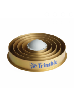
Trimble Choke Ring Antenna
Trimble Choke Ring Antenna adalah antena GNSS geodetik presisi tinggi yang dirancang untuk aplikasi permanen seperti CORS (Continuously Operating Reference Station), monitoring deformasi, dan jaringan referensi nasional...
More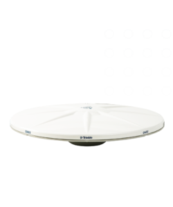
Trimble Zephyr 3 Antenna
Trimble Zephyr 3 Antenna adalah antena GNSS presisi tinggi yang merupakan penerus seri Zephyr klasik...
More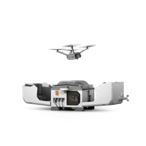
DJI Dock 3 (Drone In the Box)
Equipped with a high-performance Matrice 4D or Matrice 4TD drone, DJI Dock 3 enables 24/7 remote operation and, for the first time, supports vehicle-mounted mobile deployment, adapting easily to a variety of environments...
More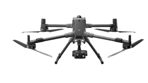
DJI Matrice 400
The DJI Matrice 400 is DJI's latest enterprise drone designed for industrial applications such as mapping, infrastructure inspection, construction, and security.
More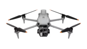
DJI Matrice 4 Enterprise
The DJI Matrice 4E is DJI's latest enterprise drone designed specifically for high-precision geospatial mapping and surveying...
More
Terrasolid – Post Processing Software
Terrasolid is a professional software for large-scale LiDAR data processing and analysis, widely used in topographic mapping, corridor mapping, forestry, electricity, mining, and infrastructure projects...
MorePIX4D Post Processing Software
Pix4Dmapper (PIX4D) is a professional photogrammetry software used to process aerial and terrestrial photos into 2D maps, 3D models, point clouds, DSMs, and DTMs with high accuracy...
MoreAgisoft Metashape – Post Processing Software
Agisoft Metashape is a professional photogrammetry software used to convert photos (aerial and terrestrial) into 3D models, orthomosaics, point clouds, DSMs, and DTMs with high accuracy...
More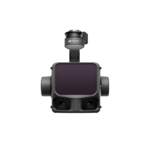
DJI Zenmuse L3
The DJI Zenmuse L3 is DJI's next-generation LiDAR (Light Detection and Ranging) payload designed for high-precision aerial mapping and geospatial surveying...
More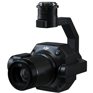
DJI Zenmuse P1
The DJI Zenmuse P1 is a full-frame photogrammetry camera payload designed for high-precision aerial mapping needs...
More