ID
EN
Homepage
News
Products
TRIMBLE Geospatial
DJI Enterprise
SENSYS
BETA
SPH Engineering
AGISOFT
PIX4D
TERRASOLID
Solutions
Solution List
CORS Solution
Services
Our Services
Main Products
Training and Support
Calibration Laboratory
Company
About Us
Why Us
Career
Contact Us
ID
EN
Insight, Innovation, and Real Experience
Show All
Case study
Article
Article
04 Jun 2026
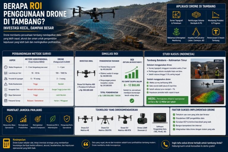
Berapa ROI Penggunaan Drone di Tambang? Investasi atau Sekadar Tren Teknologi?
Article
03 Jun 2026
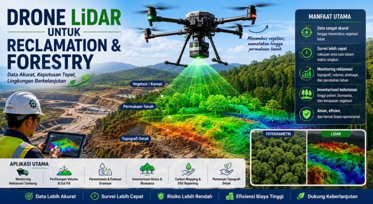
Pemanfaatan Drone LiDAR untuk Reklamasi dan Kehutanan: Investasi Geospasial yang Mulai Menjadi Standar Industri
Article
29 May 2026
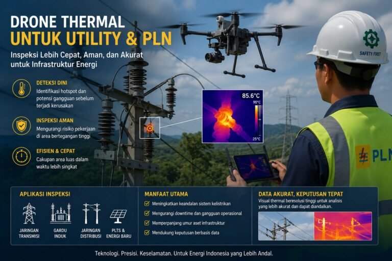
Pemanfaatan Drone Thermal untuk Utility & PLN: Teknologi yang Mengubah Cara Pemeliharaan Infrastruktur Energi
Article
03 Jun 2026
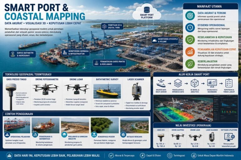
Smart Port & Coastal Mapping: Fondasi Digital untuk Pelabuhan Modern dan Infrastruktur Pesisir Indonesia
Article
28 May 2026
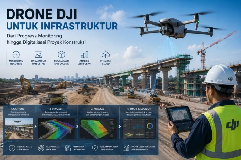
Pemanfaatan Drone DJI Enterprise untuk Infrastruktur: Dari Progress Monitoring hingga Digitalisasi Proyek Konstruksi
Article
21 May 2026
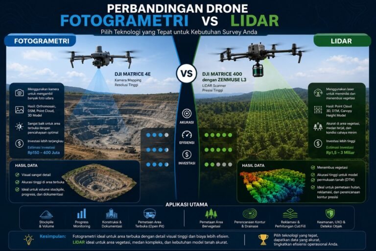
Drone Fotogrametri vs Drone LiDAR: Mana yang Lebih Tepat untuk Survey Tambang, Perkebunan, dan Konstruksi?
Article
09 Jun 2026
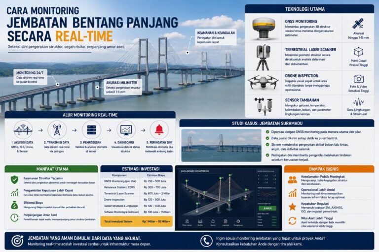
Cara Monitoring Jembatan Bentang Panjang Secara Real-Time
Article
28 May 2026
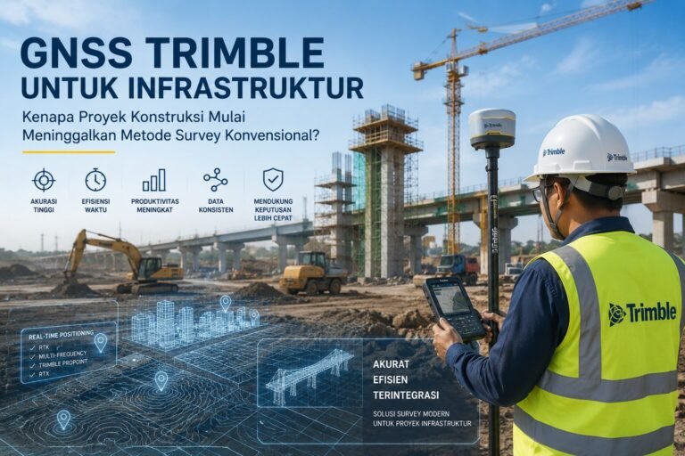
Pemanfaatan GNSS untuk Infrastruktur: Kenapa Proyek Konstruksi Mulai Meninggalkan Metode Survey Konvensional?
Case study
03 Jun 2026
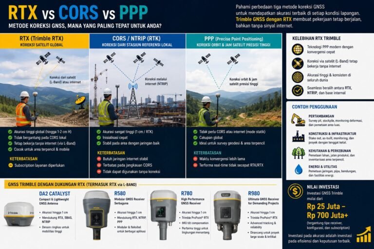
RTX vs CORS vs PPP: Memilih Metode Koreksi GNSS yang Tepat untuk Kondisi Lapangan di Indonesia
1
…
3
4
5
…
7
English
Indonesian