Plantation & Forestry
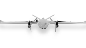
Drone VTOL Raybe
The RAYBE VTOL drone is designed for complex aerial mapping challenges in difficult terrain...
More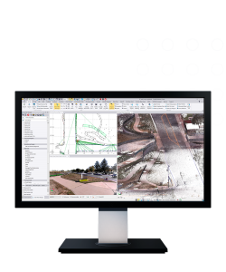
Trimble Business Center (TBC)
Trimble Business Center (TBC) is a survey and geospatial data processing software designed to integrate, process, analyze, and produce professional deliverables from various data sources—GNSS, total station, digital level, laser scanning, mobile mapping, and UAV...
More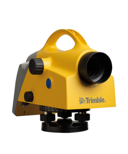
Trimble DiNi Digital Level
Trimble DiNi (short for Digital Nivel / Digital Level) is a high-precision digital waterpass from Trimble that is used to measure height differences (elevation) quickly and accurately in the field...
More
Trimble TDC6 Field Controller
The Trimble TDC6 is a professional-grade portable field data controller specifically designed for managing data capture in the field, including control of survey instruments such as GNSS receivers and total stations...
More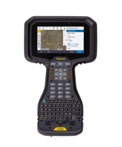
Trimble TSC510 Field Controller
The Trimble TSC510 is a professional-grade portable field data controller designed to manage survey instruments such as GNSS receivers and total stations, and support efficient survey and mapping workflows in the field...
More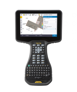
Trimble TSC710 Field Controller
The Trimble TSC710 is a professional-grade field controller designed to efficiently manage survey equipment such as GNSS receivers, total stations, and mobile mapping systems in the field...
More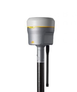
Trimble R980
Premium GNSS receiver with ProPoint GNSS engine and Trimble TIP tilt compensation for high RTK accuracy in difficult conditions...
More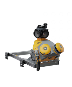
Trimble MX60 Mobile Mapping System
The Trimble MX60 is a next-generation mobile mapping system designed to efficiently capture high-quality 3D geospatial data while on the move.
More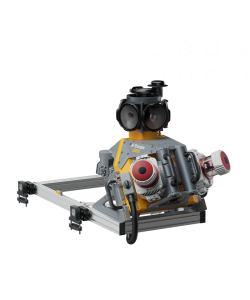
Trimble MX90 Mobile Mapping System
The Trimble MX90 is a mobile mapping system (MMS) designed to capture 3D geospatial data with a high degree of accuracy and efficiency while on the move...
More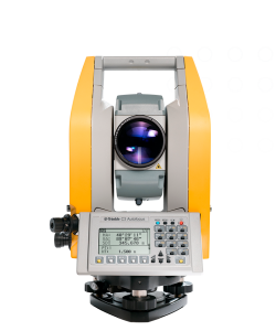
Trimble C3 Mechanical Total Station
The Trimble C3 Mechanical Total Station is a mid-range, professional-grade manual (non-robotic) total station designed to deliver accurate angle and distance measurements, robust field performance, and efficient workflow...
More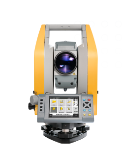
Trimble C5 Mechanical Total Station
Trimble C5 Mechanical Total Station adalah total station manual kelas profesional yang dirancang untuk memberikan akurasi pengukuran sudut dan jarak yang tinggi, performa stabil, serta workflow survei yang efisien...
More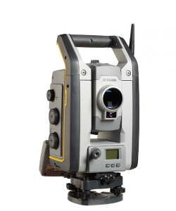
Trimble S7 Robotic Total Station
Trimble S7 adalah total station kelas profesional menengah yang dirancang untuk mendukung kebutuhan survei komprehensif dengan keandalan tinggi, presisi kuat, dan workflow yang intuitif...
More