Trimble Geospatial
All Products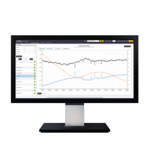
Trimble 4D Control Office software
Trimble 4D Control is a software for monitoring deformation and structural movement designed for real-time or periodic automated monitoring of infrastructure and critical areas...
More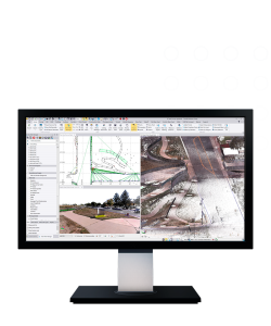
Trimble Business Center (TBC)
Trimble Business Center (TBC) is a survey and geospatial data processing software designed to integrate, process, analyze, and produce professional deliverables from various data sources—GNSS, total station, digital level, laser scanning, mobile mapping, and UAV...
More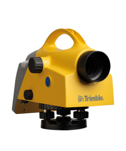
Trimble DiNi Digital Level
Trimble DiNi (short for Digital Nivel / Digital Level) is a high-precision digital waterpass from Trimble that is used to measure height differences (elevation) quickly and accurately in the field...
More
Trimble TDC6 Field Controller
The Trimble TDC6 is a professional-grade portable field data controller specifically designed for managing data capture in the field, including control of survey instruments such as GNSS receivers and total stations...
MoreDJI Enterprise
All Products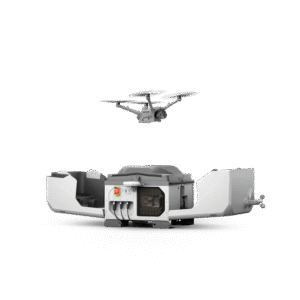
DJI Dock 3 (Drone In the Box)
Equipped with a high-performance Matrice 4D or Matrice 4TD drone, DJI Dock 3 enables 24/7 remote operation and, for the first time, supports vehicle-mounted mobile deployment, adapting easily to a variety of environments...
More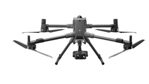
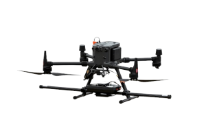
DJI Matrice 400
The DJI Matrice 400 is DJI's latest enterprise drone designed for industrial applications such as mapping, infrastructure inspection, construction, and security.
More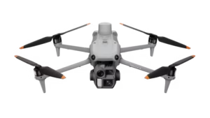
DJI Matrice 4 Enterprise
The DJI Matrice 4E is DJI's latest enterprise drone designed specifically for high-precision geospatial mapping and surveying...
More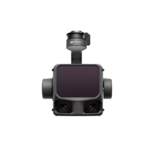
DJI Zenmuse L3
The DJI Zenmuse L3 is DJI's next-generation LiDAR (Light Detection and Ranging) payload designed for high-precision aerial mapping and geospatial surveying...
MoreSENSYS
All Products
MagDrone R3
The MagDrone R3 is a drone-based airborne magnetometer system designed to perform high-resolution magnetic surveys in a variety of geospatial applications...
More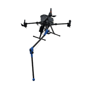
MagDrone R1
The MagDrone R1 is a drone-based airborne magnetometer solution designed for fast and efficient magnetic surveys of small to medium-sized areas...
More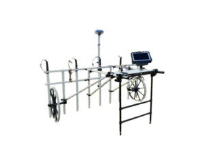
MAGNETO MX V4 – Modular Large Area Magnetometer Survey System
MAGNETO MX V4 is an area magnetometer survey system...
MoreBETA
All Products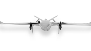
Drone VTOL Raybe
The RAYBE VTOL drone is designed for complex aerial mapping challenges in difficult terrain...
MoreProduk Lainnya
All Products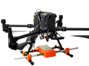
Zond Aero LF — Aerial Low-Frequency
Zond Aero LF is a low-frequency electromagnetic based airborne geophysical survey system designed to identify subsurface anomalies such as valuable minerals, geological structures, and buried mineralized zones...
More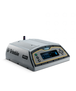
Trimble Alloy
Trimble Alloy adalah receiver GNSS modular yang dirancang untuk kebutuhan survei, pemetaan, monitoring, dan aplikasi presisi tinggi lainnya...
More
Trimble Choke Ring Antenna
Trimble Choke Ring Antenna adalah antena GNSS geodetik presisi tinggi yang dirancang untuk aplikasi permanen seperti CORS (Continuously Operating Reference Station), monitoring deformasi, dan jaringan referensi nasional...
More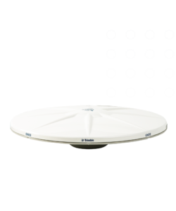
Trimble Zephyr 3 Antenna
Trimble Zephyr 3 Antenna adalah antena GNSS presisi tinggi yang merupakan penerus seri Zephyr klasik...
More