Mining
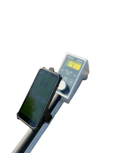
ARCH I – Handheld Prospection Device
ARCH I is a handheld prospecting device used for initial surveys and geophysical exploration, particularly for the rapid and portable detection of subsurface magnetic field anomalies...
More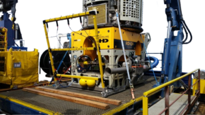
FGM3D UWD
The FGM3D UW is a 3-axis fluxgate magnetometer specifically designed for offshore and underwater applications, including ROV (Remotely Operated Vehicle) surveys, underwater infrastructure inspections, underwater object detection such as UXO (Unexploded Munitions), and seafloor magnetic mapping...
More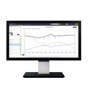
Trimble 4D Control Office software
Trimble 4D Control is a software for monitoring deformation and structural movement designed for real-time or periodic automated monitoring of infrastructure and critical areas...
More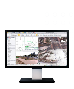
Trimble Business Center (TBC)
Trimble Business Center (TBC) is a survey and geospatial data processing software designed to integrate, process, analyze, and produce professional deliverables from various data sources—GNSS, total station, digital level, laser scanning, mobile mapping, and UAV...
More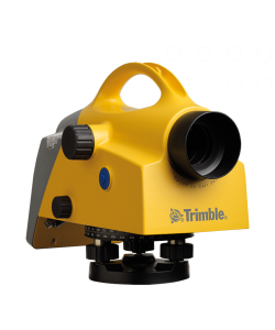
Trimble DiNi Digital Level
Trimble DiNi (short for Digital Nivel / Digital Level) is a high-precision digital waterpass from Trimble that is used to measure height differences (elevation) quickly and accurately in the field...
More
Trimble TDC6 Field Controller
The Trimble TDC6 is a professional-grade portable field data controller specifically designed for managing data capture in the field, including control of survey instruments such as GNSS receivers and total stations...
More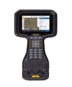
Trimble TSC510 Field Controller
The Trimble TSC510 is a professional-grade portable field data controller designed to manage survey instruments such as GNSS receivers and total stations, and support efficient survey and mapping workflows in the field...
More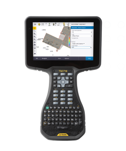
Trimble TSC710 Field Controller
The Trimble TSC710 is a professional-grade field controller designed to efficiently manage survey equipment such as GNSS receivers, total stations, and mobile mapping systems in the field...
More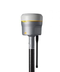
Trimble R980
Premium GNSS receiver with ProPoint GNSS engine and Trimble TIP tilt compensation for high RTK accuracy in difficult conditions...
More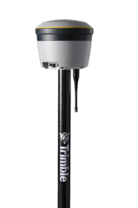
Trimble R580
GNSS receiver rover with Trimble ProPoint technology supporting multi-constellation and CenterPoint RTX...
More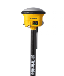
Trimble R780
The Trimble R780 is an integrated GNSS receiver designed for surveying and mapping work with high flexibility...
More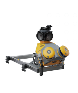
Trimble MX60 Mobile Mapping System
The Trimble MX60 is a next-generation mobile mapping system designed to efficiently capture high-quality 3D geospatial data while on the move.
More